Baldwin (Wis.) Pierce County (Wis.)

Área de elementos

Taxonomía

Código

Nota(s) sobre el alcance

    Nota(s) sobre el origen

      Mostrar nota(s)

        Términos jerárquicos

        Baldwin (Wis.) Pierce County (Wis.)

          Términos equivalentes

          Baldwin (Wis.) Pierce County (Wis.)

            Términos asociados

            Baldwin (Wis.) Pierce County (Wis.)

              6 Descripción archivística resultados para Baldwin (Wis.) Pierce County (Wis.)

              6 resultados directamente relacionados Excluir términos relacionados
              US ARC PH 2019.001.075 · Unidad documental simple
              Parte de Photographic postcard collection

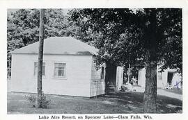
              Postcard with image of two cottages at the Lake Aire Resort in Burnett County, near Clam Lake, Wisconsin. The cottages both have lawn chairs by the doors. One cottage has been marked with an "X", which is not explained. Test printed on verso: G. R. Brown Co., 324 Lake, Eau Claire, Wisconsin Printed on Etch Tone postcard paper. Unused.
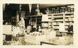
              Dresser store, Centuria, Wisconsin
              US ARC PH 2019.001.074 · Unidad documental simple · [ca. 1916]
              Parte de Photographic postcard collection

              Real-photo postcard with image of Printed on Azo paper with all four triangles pointing up (used 1904-1918). Handwritten on verso: "Dresser Store, Centuria, Wisc." In a different hand: "1916," and "seed packets in racks." Otherwise, unused.

              Sanborn fire insurance maps
              US ARC ARC 2023.009 · Colección · 1902-1930

              The Sanborn Co. was founded in 1867 by D.A. Sanborn, to draw maps of the downtown districts of cities across the U.S. These maps could then be consulted by insurance companies if a building burned to research different characteristics about the business and the physical structure. The company stopped making the fire insurance maps in 1961, due to other sources being used to obtain the needed information. Today, they serve as a wonderful resource for tracing the growth of cities and tracking where businesses were located decades ago. We have these maps on microfilm for the entire state of Wisconsin. We also have copies of the actual maps in paper format for cities in our four-county area. The dates range from approximately the 1880s to the 1920s for our area. The maps were not issued regularly, so do not expect any pattern as to when the maps came out for various cities.

              Sin título